Bill Schultz introduced our speaker, Dr. Peter Bobrowsky, whom he met on a 30 day cruise Feb-Mar last year. During sea days, Peter hosted some very interesting talks on the ship. He has almost 500 publications under his name. One being the landslide handbook, translated in a number of languages, to help those who are most affected by landslides around the globe. In the past 20+ years has delivered 100s of presentations.
The subject: Hunting great earthquakes and paleo-tsunamis. These natural events have occurred back to time immemorial as demonstrated by the earthquake mask, held at the Museum of Paleontology. Written records only go back to the time of western occupation. Prior to that the knowledge was passed down orally.
Dr. Brobowsky spoke from a geological perspective. What are known as great earthquakes are those in the Mw 8 to 9 range. These earthquakes generate catastrophic and far reaching tsunamis. The last great earthquake in B.C. was in 1700 AD. It is known that the average return period is about 300 years.
The next “big one” is expected to have an approximate 1,000 km rupture, measuring the Mw 9 range. Shaking can be expected to last for 3-5 minutes that will impact a vast region on the southwest portion of BC and the pacific northwest of the US. A large tsunami will be created that will travel across the Pacific. Aftershocks can be expected for months perhaps years after the initial quake.
By examining soil samples at more than 50 undersea sites between Washington, Oregon, and California, scientists are able to estimate the magnitude and timing of 40 major earthquakes that occurred in the Cascadia Subduction Zone since 9845 B.C. The average time between earthquakes in this zone is between 250 and 400 years.
There are quite accurate records from the 1700 A.D. Cascadia earthquake thanks to rice storage records in Japan that have been used with a back calculation of tsunami travel speeds, providing an exact date and time of the event: January 26, 1700 at 9:00 PST.
Looking back at the 1964 tsunami, maximum heights above sea level have been determined. The outer coast of Vancouver Island received the highest levels (1-15+ metres) with the highest being at the heads of inlets. Around the lower portion of the Island (Victoria), it is considered medium (1-6 metres). Along the east coast of Vancouver Island and on to the mainland over the Strait of Georgia, it is expected low (<2 metres).
Evidence is left behind after a major event that allows scientists to gather information very accurately about the event. The layers of earth beneath lakes, in forests, etc. show distinct layers: before the earthquake, during the earthquake, tsunami, post earthquake, and then years after.
The Juan de Fuca Plate is butted against the North American Plate. There are many, many annual earthquakes in Canada. There are about 4,000 of these events in western Canada – BC, Alberta and up into the Yukon. On the island alone there are about 900 per year.
The average annual global earthquake frequency varies according to magnitude – level 2.5 170,000 occurrences per year, M 3 60,000, M 4 7,500, M 5 950, M 6 120, M 7 18, and M 8 and above 1.
Large earthquakes have been seen along a linear pattern off the coast. Crustal or shallow earthquakes 30-60 km down are fairly widespread in south western BC and pacific northwest US. In BC there are magnitude 1-2 earthquakes all day long. They are so small we can’t feel or measure them. There are others that occur deeper down, in different locations than the shallow one.
Magnitude – what does it mean? As the number gets bigger the energy released increases. The strength of ground shaking, duration, and area impacted increases very quickly. For every magnitude unit, ground shaking increases 10 times. For every magnitude unit, energy released increases 32 times. The duration of shaking ranges from a few seconds (for a M 4) to several minutes (M 9). Once beyond M 9 its too difficult to measure anything precisely.
The amount of energy released increases with magnitude:
- M5 = 20,000,000 grams of TNT = a small atomic bomb
- M6 = 600,000,000 grams of TNT = a hydrogen bomb, similar to the bomb dropped on Hiroshima
- M7 = 20 billion = 30 hydrogen bombs
- M8 = 600 billion = 1,000 hydrogen bombs
- M9 = 20 trillion = 30,000 hydrogen bombs, or enough energy to boil 10,000 litres of water for every person on earth.
The earth’s crust is very thin. There is a continental crust and an oceanic crust. All of the crust is broken into various parts. When earthquakes are plotted over several decades, patterns emerge. From that pattern plate tectonics can be determined. Where these plates touch each other, friction occurs. About a dozen large pieces. Sometimes the plates move away from each other, and sometimes the push against one another. When they push against each other is when mountains are grown.
The Juan de Fuca Plate moves about 2 inches per year. In BC we have a bulge forming parallel and on part of Vancouver Island. Part of the island is going up. As the two plates meet, they are stuck. When they eventually release the land will drop.
Little bursts of pressure release some of the energy off every decade. Every plate boundary has a different cycle. Ours is about 300 years, others are 1,000. How they move, e.g., side-by-side versus frontal, and the size of the plates varies this as well.
When plotted on a map, earthquake activity corresponds with the pacific rim of fire, as well as the subduction zones where one plate slides under another. Anything larger than magnitude 8 is considered a great earthquake. The 4 largest we know of:
- 1960, Valdivia, Chile, M9.5 earthquake
- 1964, Prince William Sound, Alaska, M9.2 earthquake
- 2004, Sumatra, Indonesia, M9.1 earthquake
- 2011, Sendai, Japan, M9.0 earthquake
The 1964 Alaska earthquake event cost several millions of damages and 146 deaths. One of the things they realized after the event, was that there were large swaths of land above water. Also noticed other areas were flooded. The land stayed under water. Forests that were flooded died. A couple of geologists and physicists explained what occurred – strain accumulation; oceanic plate pushes against the land mass. Similar action as that of a carpet that is being moved. Thrust rupture – edge of land pushes up and a ridge beyond it sinks down. Over time it all recurs.
Near Tofino and down the coast they were able to determine exactly what happened for past events. When excavated, they found paleo soil layer, tsunami deposit, then modern soil. Carbon dating shows that the events happen every few thousand of years. Can see many of these events have happened over the centuries.
Drowned or sunken forests are a great signpost for the events. Lakes provide great examples, near the ocean, of tsunami activity over time. More recently work has been done along the BC coast into Alaska working with the Coast Guard taking core samples from the side of a ship. When looked at can see the bands of under water landslides. With all this info can map out what occurs. Modelling shows how a tsunami moves.
There is concern about when it will it happen again. On average there are 250-400 years apart. Our last one occurred about 350 years ago, so theory is that we should be prepared for another mega event at anytime over the next 50 years. Vancouver Island and Pacific Northwest will be hardest hit. There are a lot of great resources to ensure you are prepared.
Where are the most vulnerable areas, e.g., Richmond? Part of the issue is knowing what areas are below sea level, then could be affected by water intrusion or the shaking damage occurring is dependent on the type of ground its on. Solid rock is the safest. The type of building also affects this – wood is more pliable than brick. The design and structure of the building on our west coast takes all of this into account.
Preparedness is key – make sure water tanks are strapped. Make sure that the home is drilled into the foundation. With regards to a tsunami, modellers have done a great job. Height will be about 1 metre in Vancouver, 2 metres in Victoria. Port Alberni probably the worst – last one was 25 feet in 1964. They do have very good emergency plans in place.
The high rises in Vancouver what can they withstand? Usually about 7-7.5. What will probably happen is that when we see a few minutes of shaking the glass and facades will crumble, even if the buildings survive. Be sure to get out of the streets.
Lots of good resources available to us for preparation.

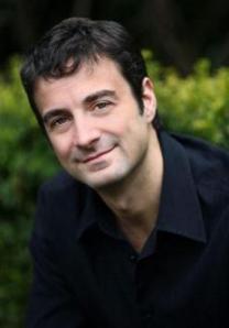 Daniel’s novel, Lost Immunity, is a cautionary tale about vaccine hesitancy! No other medical advance has ever engendered such myth, hysteria and passion. Emotion often supplants reason. But could the divide between the pro and anti-vax camps lead to murder?”
 developed for a TV series. In his twelfth novel, LOST IMMUNITY, Daniel tackles the issue of vaccine hesitancy and the potential impact on a global outbreak, applying his real-life experience working on the frontlines through the COVID pandemic.