Speaker Recap for April 16, 2012

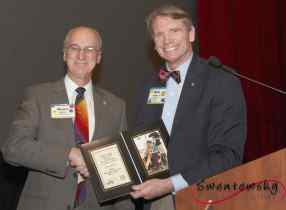
Well if you missed our April 16th lunch meeting you missed a great lecture by one of our favorite speakers – world traveler and tale spinner Bruce Hester! He graciously returned (for a third time) to educate us all on how our States got to look like they do. And Lord knows we all have a lot to learn – Bruce informed us that our own John “Photo Op” Frisch thought a “cartographer” was someone who photographs cars for a living! Geez, looks like we are all in dire need of a sage like Bruce! (And educate us he did; but don’t quote me on the dates, places and names, as they came too “fast and furious” for this reporter’s pen to handle.)
For starters, we learned that most of our State’s borders came to be over a process of some 100 years (between 1763-1853) during which time Congress chose boundaries based on any number of differing (and often somewhat arbitrary) criteria – such as the locations of shared rivers, or historical boundaries from colonial days (like for Catholic Maryland in 1631, or Quaker Pennsylvania in 1763), or subsequent land grants or purchases (like the Northwest Territories after the French and Indian War of 1763, the Louisiana Purchase of 1803), or small “side deals” with the English over parts of Canada (1818), or France (1819), or “the Republic of Texas” (1845), or the “Battle of Toledo!”
We also learned that most of the roughly “rectangular” shaped states in the mid-west and north-east were formed based on an old Jeffersonian rule that “all States should be created equal,” which resulted in Congress making several states the same “heights” of 3 degrees latitude (such as Kansas, Nebraska, North and South Dakota), or 4 degrees latitude (such as Colorado, Wyoming, and Montana), or seven degrees longitude (Washington and Oregon). Who’d a thunk?
But when it came to our own great State of California, we learned that not all State’s are created equally! Around 1850 our northern border with Oregon was chosen because it marked the approximate line from which the rivers tended to flow to the south, and our eastern boundary marked the approximate line which ensured that all the known gold reserves were on the California side (sorry Nevada!), and our southern boundary was formed after a compromise with Mexico which roughly “split” the San Diego harbor between both countries! Go figure!
As we travel across our states’ borders this summer we can sit back and share a bit about how they came to be that way! Thank you Bruce for an enlightening and always entertaining presentation! We look forward to your next visit. (And when your kids or grand kids ask you “What did Delaware?” you will know to answer “She wore a New Jersey”!)