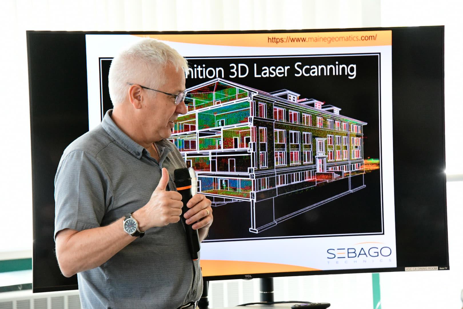
 On September 10, 2019, Westbrook-Gorham Rotarian Owens McCullough, Sr VP Sebago Technics, introduced us to two of his employees – Rich Stone and Kira Harmon. Both Rich and Kira are graduates of WRVC - Rich in Computer Repair Technology and Kira in Drafting. They both also attended SMCC and Rich is currently studying to Architecture at University of Maine Augusta. Both are experts in the emerging field of high definition surveying.
High definition surveying is used for a large variety of projects. For example, it can be used for 3D documentation of historic buildings for restoration without removing pieces of the building, as they did at Bate College for window restoration. It can be used for terrestrial laser scanning of larger sites, like the Penobscot Narrows Bridge in Bucksport and the old quarry at Rock Row in Westbrook. It can also be used for conceptual modeling.
Sites are set up with targets and spheres on walls and on the ground to start the process. These are mapped and used to help “stitch” a survey together. The process is very accurate and much faster than traditional surveying by capturing millions of data points. The impact on the site from the survey is 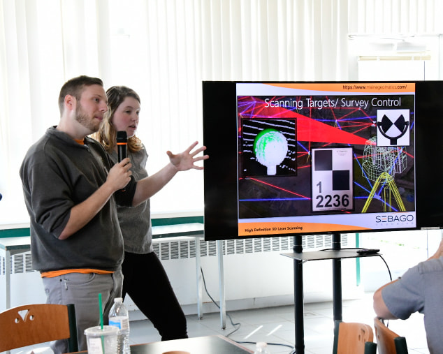 minimized over traditional methods. For example, a recent survey at the Jetport terminal was complete in one night without disrupting passenger traffic. It can be used to quickly scan the existing profile of a road or topographical location and can be used at night to avoid traffic disruption.
minimized over traditional methods. For example, a recent survey at the Jetport terminal was complete in one night without disrupting passenger traffic. It can be used to quickly scan the existing profile of a road or topographical location and can be used at night to avoid traffic disruption. The high definition surveying team can record the historical (current) condition of a site based on the intensity of wavelengths returned. Different materials like glass and brick reflect different wavelengths back to the scanners. This new technology can be used in conjunction with traditional methods, like as-built plans, to provide a baseline of existing conditions that can help with future work on a building or can be used for later comparison.
The technology has been in use at Sebago Technics since 2013, but the field is still evolving with equipment remaining quite expensive. Use of drones is also emerging in this field, but those are also very expensive at this time.